|
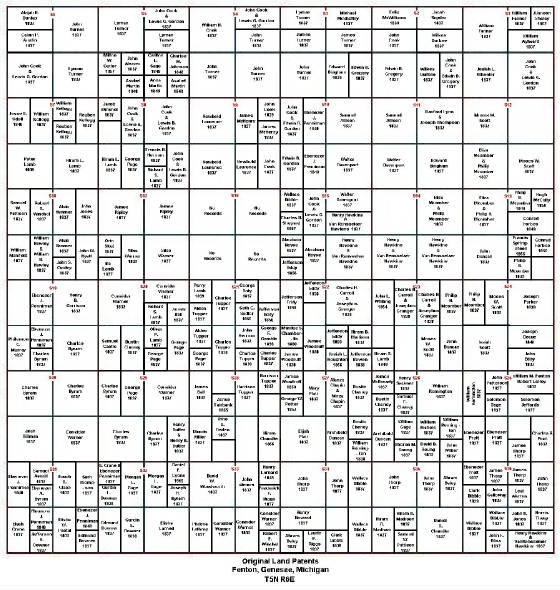
To use the map below, find the person you are seeking in the land patents
on the previous page. Make note of the Section number and the Aliquot Parts.
Land Grants are ploted by sectons. Each section is then bought whole,
halved, quartered, etc.Then those sections can be whole, halved, or quartered.
To find the section your looking for, find the red letter S followed
by the red numbers of the section you need. such as say, you are looking for Sect. 15, you would look for the red S15. It's
that simple. The section numbers are listed at the top center of each section, so if your looking for the NW part of S15,
it would be located to the left of the red S15. The NW part would be the whole upper left corner of Section 15.
|
| Original Land Patents Fenton, Genesee, Michigan |
|
